

SQL Server 2025 Standard – 2 Cores License
LKR 750,000LKR 174,900
 69% Off
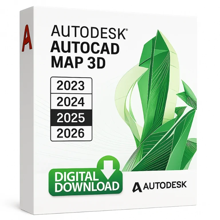
License validity for 1 year. Download from AutoDesk™ website. 24/7 support, 7 days a week. Best prices on the market. No external links.
 Pay LKR 904.70 × 3 installments with KOKO
 System Compatibility and Technical Requirements Supported Operating System: Windows 10 (64-bit) Windows 11 (64-bit) Note: AutoCAD Map 3D is not natively available for macOS, but it can be used via virtualization tools like Parallels Desktop, VMware Fusion, or Boot Camp on Intel-based Macs. Recommended Hardware: Processor: Multi-core, 3.0 GHz or faster (Intel Core i7 / AMD Ryzen 7 recommended) RAM: Minimum 16 GB (32 GB recommended for large datasets) Graphics: DirectX 12-compatible GPU with 4 GB VRAM (NVIDIA Quadro recommended) Disk Space: 10 GB free for installation Resolution: 1920×1080 or higher
License validity for 1 year. Download from AutoDesk™ website. 24/7 support, 7 days a week. Best prices on the market. No external links.
Key Features of AutoCAD Map 3D
1. GIS and CAD Integration
Import, edit, and analyze spatial data directly within the AutoCAD environment. AutoCAD Map 3D supports standard GIS formats including:
This capability enables effective data management without requiring external GIS platforms.
2. Geolocation and Coordinate Systems
Georeference CAD drawings using real-world coordinate systems. Users can assign custom geographic projections and overlay multiple spatial data sources for comprehensive mapping and accuracy.
3. Infrastructure and Utility Network Modeling
Design and manage complex utility networks, such as:
Support includes network tracing, simulation, topological analysis, and tracking of connections between assets.
4. Thematic Mapping and Symbol Management
Create custom thematic maps based on alphanumeric data attributes. Define and manage symbology, display styles, and dynamic visualizations to present spatial insights clearly and effectively.
5. Geospatial Analysis Tools
Conduct in-depth territory analysis using tools that enable:
These features are essential for impact studies, land development, and resource planning.
6. Real-Time Database Connectivity
Connect directly to spatial databases for live data querying and editing, removing the need for data conversions or intermediate files. This ensures data integrity and continuity throughout the design lifecycle.
7. Reporting and Output Automation
Generate cartographic outputs, print layouts, and analytical reports directly from your models. These tools support better communication between design teams, clients, and stakeholders in planning, decision-making, and regulatory processes.
Island-wide delivery
Best price













 Pay LKR 904.70 × 3 installments with KOKO
 System Compatibility and Technical Requirements Supported Operating System: Windows 10 (64-bit) Windows 11 (64-bit) Note: AutoCAD Map 3D is not natively available for macOS, but it can be used via virtualization tools like Parallels Desktop, VMware Fusion, or Boot Camp on Intel-based Macs. Recommended Hardware: Processor: Multi-core, 3.0 GHz or faster (Intel Core i7 / AMD Ryzen 7 recommended) RAM: Minimum 16 GB (32 GB recommended for large datasets) Graphics: DirectX 12-compatible GPU with 4 GB VRAM (NVIDIA Quadro recommended) Disk Space: 10 GB free for installation Resolution: 1920×1080 or higher
License validity for 1 year. Download from AutoDesk™ website. 24/7 support, 7 days a week. Best prices on the market. No external links.
Key Features of AutoCAD Map 3D
1. GIS and CAD Integration
Import, edit, and analyze spatial data directly within the AutoCAD environment. AutoCAD Map 3D supports standard GIS formats including:
This capability enables effective data management without requiring external GIS platforms.
2. Geolocation and Coordinate Systems
Georeference CAD drawings using real-world coordinate systems. Users can assign custom geographic projections and overlay multiple spatial data sources for comprehensive mapping and accuracy.
3. Infrastructure and Utility Network Modeling
Design and manage complex utility networks, such as:
Support includes network tracing, simulation, topological analysis, and tracking of connections between assets.
4. Thematic Mapping and Symbol Management
Create custom thematic maps based on alphanumeric data attributes. Define and manage symbology, display styles, and dynamic visualizations to present spatial insights clearly and effectively.
5. Geospatial Analysis Tools
Conduct in-depth territory analysis using tools that enable:
These features are essential for impact studies, land development, and resource planning.
6. Real-Time Database Connectivity
Connect directly to spatial databases for live data querying and editing, removing the need for data conversions or intermediate files. This ensures data integrity and continuity throughout the design lifecycle.
7. Reporting and Output Automation
Generate cartographic outputs, print layouts, and analytical reports directly from your models. These tools support better communication between design teams, clients, and stakeholders in planning, decision-making, and regulatory processes.
Island-wide delivery
Best price
Digital Delivery: Sent directly to your registered e-mail address.
Maximum delivery timeframe: 24 hours.
No reviews yet for this product.
